

















DroneWild wildlife monitoring case study header with a deer detected inside a bounding box

How Keymakr helped DroneWild
and Addax Data Science
prepare data for their wildlife
monitoring application

Wildlife management, ecological
systems, conservation technology

Project for:
Services:
Overview:
Case study period 06.2025 to 07.2026
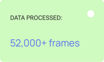
52,000+ frames of data processed
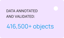
416,500+ objects annotated and validated
Team of up to 10 specialists
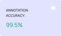
99.5% annotation accuracy

Introduction

Wildlife monitoring helps conservation organizations and land managers assess population sizes and distribution, track changes in ecosystems, and make informed decisions about natural resource management. However, traditional ground-based surveys require more time and human resources. The presence of survey teams can also affect animal behavior, while some areas remain difficult to access for regular observation.

DroneWild develops solutions that combine drone imagery, software, and machine learning for wildlife monitoring. Its technologies help detect and classify different animal species, including mammals and birds. These solutions are designed for wildlife rangers, ecologists, landowners, and researchers who need to survey areas more accurately and efficiently while minimizing disturbance to the natural environment.

Addax Data Science specializes in developing technological solutions for ecological research and nature conservation. For DroneWild, the company developed a web application for processing drone imagery, which also contributed to object detection models designed to recognize and classify UK mammal species.

Sika deer and fallow deer detected and classified with bounding boxes in drone imagery

The resulting application allows land management professionals to upload wildlife survey materials and receive data on the number, species, and locations of detected animals, along with distribution and density maps, statistics, and annotated images for further review.

Keymakr joined the project to detect, classify, and annotate animals in order to provide ground truth for model training.

The challenge

Although the project involved standard bounding box annotation, its real complexity came from the characteristics of the data itself.

  • Finding animals
    The drone imagery covered vast areas and had extremely high resolution. At higher flight altitudes, animals could occupy only a few pixels. Detection became even more difficult when an animal was in shadow, partially hidden among bushes, or positioned against a similarly colored background. Due to the project's technical scope, automated pre-annotation was not sufficiently effective. Therefore, every frame had to be annotated or reviewed manually.
Animals appearing as a few pixels annotated in high-altitude drone imagery of an open hillside
  • Variation in object counts
    The number of animals in a single image could range from just a few to hundreds. When searching for solitary animals, specialists had to examine the entire image carefully, even if most of it appeared empty. In large groups, overlaps made the task more complex: the team had to determine which visible fragments belonged to different individuals and annotate each animal correctly.
Hundreds of overlapping animals annotated with individual bounding boxes in a single drone frame
  • Visual similarity between species
    Similar species were difficult to distinguish in aerial imagery because of the distance, limited visible detail, and partial occlusion by vegetation. Accurate classification was just as important as detecting the animal itself, since errors directly affected species-specific statistics.
Feral goats classified with bounding boxes on a vegetated hillside in aerial imagery
The solution

The work progressed through several iterations, with DroneWild and Addax Data Science providing new batches of images and videos as the model evolved, the class structure expanded, and additional survey scenarios emerged.

Systematic image review and detection of hard-to-spot animals

One of the most time-consuming parts of the project was detecting animals in imagery captured at high altitudes. These frames covered vast areas, while individual animals could appear as tiny dots or patches that were almost indistinguishable from the surrounding landscape.

The Keymakr team reviewed each image systematically, moving through it zone by zone, adjusting the zoom, and examining areas with dense vegetation, shadows, uneven terrain, and variations in surface color. Particular attention was paid to locations where an animal's silhouette could blend into grass, bushes, soil, or rocks.

Animals blending into a grey hillside detected zone by zone during systematic image review
Annotating dense groups and solitary animals

The number of objects per frame varied considerably. Some images contained only a few animals, while others showed large groups. In the most densely populated frames, the number of objects reached 900.

In low-density images, most of the time was spent searching for animals across a large area. High-density images presented a different challenge: each animal had to be separated from neighboring objects, even when individuals overlapped or were only partially visible.

The team analyzed body positions, contours, and visible fragments to determine whether a particular part of the image belonged to an already annotated animal or represented a separate object. In large groups, maintaining annotation completeness and avoiding missing animals within dense clusters became a priority.

Differences in group size also affected the collection of training examples. For species that typically gathered in large herds, many instances could be obtained from a limited number of images. For solitary or less common species, more frames had to be reviewed to collect a sufficient variety of examples under different survey conditions.

Dense group of animals annotated individually across a vegetated slope in drone imagery
Refining species classification and expanding the class structure

In its early stages, the taxonomy included approximately ten classes. Some visually similar animals were grouped into broader categories, allowing the model to begin by recognizing general object classes. As the project progressed, the class structure became more detailed, and the total number of classes increased.

Roe deer and muntjac deer classified by species and sex with separate bounding boxes
Video annotation using interpolation

Although most of the project data consisted of individual images, the team also worked with drone-captured video footage.

When processing videos, specialists annotated animals in keyframes and then used interpolation to automatically generate bounding boxes for the intervening frames. When both the camera and the object moved smoothly, this allowed the annotation to be extended across a sequence without having to manually create every bounding box.

After interpolation, the specialists reviewed the intermediate frames and adjusted the annotations whenever an animal changed direction, became partially obscured by vegetation, or shifted position relative to the camera.

Pre-annotation validation and quality control

At certain stages of the project, Keymakr used pre-annotations; however, they remained a supporting tool: even in relatively simple frames, specialists still had to verify class assignments, bounding box placement, and the presence of any missed objects.

Pre-annotation was less effective in high-altitude images and frames containing dense groups. The model could miss small animals, incorrectly separate neighboring objects, or confuse visually similar species. Therefore, every frame underwent a complete manual review, regardless of whether automated annotations were available.

Quality control focused primarily on detection completeness and classification accuracy. Specialists rechecked complex areas, dense groups, peripheral regions of each frame, and animals partially obscured by vegetation. This helped identify missed individuals and maintain an average annotation accuracy of 99.5%.

Chinese water deer detected with high confidence among dense vegetation after manual review

Results

This collaboration helped create a large-scale dataset of annotated aerial images and video frames for training a model designed to detect and classify animals under real-world wildlife survey conditions. The project demonstrates how high-quality data annotation can transform aerial imagery into a practical tool for ecological monitoring.

416,500 objects annotated and validated
The data included both solitary animals against complex natural backgrounds and dense groups containing hundreds of objects. The average accuracy of data annotation was maintained at 99.5%.
52,000 frames processed
Most of the data consisted of individual images, supplemented by several thousand video frames. The dataset covered different flight altitudes and survey conditions, landscape types, object densities, and levels of animal visibility.
Expanded model taxonomy
The number of classes increased as the project evolved. Some of the initial broad categories were divided into more specific classes, supporting the model's transition from general animal detection to more detailed recognition of individual species.
A foundation for digital wildlife monitoring
The delivered data is actively being used to train a model that will become part of DroneWild's web application. Users will be able to upload survey materials and receive structured outputs, including animal counts and locations, distribution and density maps, statistics, tables, and images showing detection results.
"Machine learning was a new area for the project. By working with Addax Data Science and Keymakr, we were able to go from raw drone survey imagery to a high-quality training dataset and working detection models. Addax brought real depth of expertise in wildlife detection modeling, and Keymakr's annotation work was accurate, consistent, and delivered to a high standard throughout. Communication across the project was excellent from start to finish, and the results now sit at the heart of the DroneWild web application. We would happily work with both teams again on future phases of the project."
Quote icon

Ben Harrower, MSc MICFor, DroneWild

"This was a great collaboration from start to finish. The Keymakr team handled a challenging dataset with a high level of accuracy and attention to detail, and communication throughout the project was excellent. Working together with DroneWild and Keymakr allowed us to build the high-quality training dataset we needed for a demanding real-world wildlife detection problem."
Quote icon

Peter van Lunteren, Data scientist & ecologist at Addax Data Science

"The Keymakr team is very grateful to DroneWild and Addax Data Science for a highly collaborative and inspiring experience. From the start, our teams established a strong understanding and maintained close communication through regular task discussions and an iterative approach. This enabled us to deliver high-quality annotations and fully meet the partner's expectations.

The project was particularly inspiring due to its environmental and social impact, addressing important challenges for our planet, wildlife, and ecosystems. We were proud to contribute to such a meaningful initiative.

A special thank you to Ben and Peter for their trust and excellent collaboration. We look forward to continuing our partnership on future projects."
Quote icon

Gleb Zakharov, Keymakr PM

Reviews
on

down-line
g2
star
star
star
star
star

"Delivering Quality and Excellence"

The upside of working with Keymakr is their strategy to annotations. You are given a sample of work to correct before they begin on the big batches. This saves all parties time and...

star
star
star
star
star

"Great service, fair price"

Ability to accommodate different and not consistent workflows.
Ability to scale up as well as scale down.
All the data was in the custom format that...

star
star
star
star
star

"Awesome Labeling for ML"

I have worked with Keymakr for about 2 years on several segmentation tasks.
They always provide excellent edge alignment, consistency, and speed...

More
cases

down-line
Confidential client icon

Automotive

Delivering scalable traffic detection data for a major automotive company

SoundAware logo

MusicTech

Providing consensus-based media monitoring to help SoundAware protect the intellectual property rights of creators

Cognex logo

Robotics

Helping Cognex with high-quality OCR and object detection datasets for industrial automation