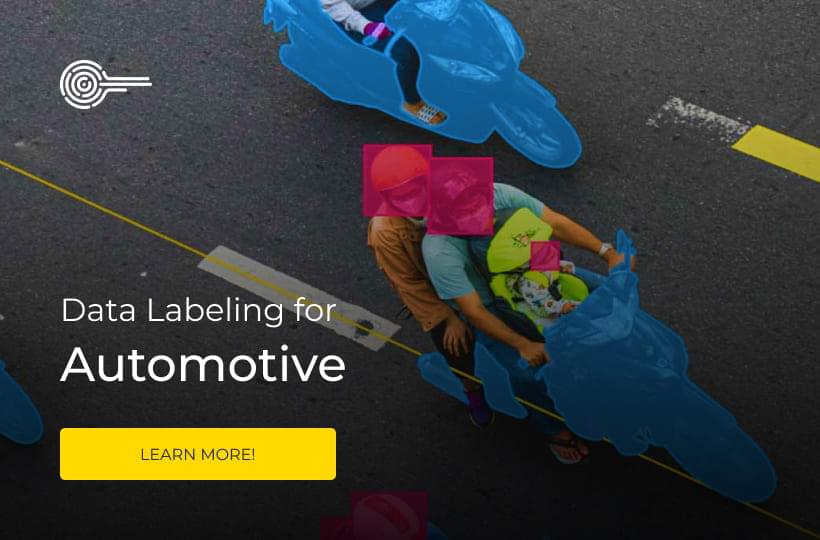
Smart Cities: Annotating Urban Data for Traffic, Safety, and Planning

Modern cities integrate sensors, IoT networks, and machine learning to optimize everything from traffic lights to emergency response systems. These technologies require high-quality training inputs to recognize pedestrians, predict traffic jams, or identify infrastructure risks. Without this careful training, AI systems couldn't tell a pothole from a shadow.
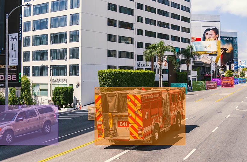
Work in infrastructure monitoring, urban planning, and traffic management relies on pixel-perfect mapping of the environment. Street cameras detect anomalies, and sensors predict bridge stress points because teams have trained algorithms using millions of precisely labeled data points.
A single mislabeled road sign in training data can lead to incorrect navigation instructions for entire fleets of vehicles. Therefore, annotation processes combine algorithmic efficiency with human expertise, ensuring that systems interpret the complexity of the real world as reliably as humans.
Quick Take
- Internet of Things networks and machine learning are the foundation of modern municipal operations.
- The accuracy of training datasets impacts public safety and resource allocation.
- Hybrid human and AI validation processes prevent systemic errors.
- Continuous data refinement enables predictive maintenance of aging infrastructure.

Understanding Smart Cities
Smart cities use modern digital technologies and data to improve residents' quality of life, efficient resource management, and sustainable development.
Key characteristics of a smart city:
- Digital infrastructure. Internet of Things (IoT), sensors, cameras, 5G networks.
- Traffic and transport management. "Smart" traffic lights, public transport with GPS, and parking systems.
- Energy conservation and ecology. Smart grids, solar panels, air and water quality monitoring.
- Security. Video surveillance, crime prediction systems, panic buttons.
- E-government. Online document processing, tax payment, electronic queues.
- Citizen participation. Mobile applications for feedback, voting, and reporting problems in the city.
Smart City Data Annotation
Smart city data annotation is the process of labeling, structuring, and classifying data from city sensors, cameras, meters, transportation systems, and other sources. Training AI models, automating city processes, and making real-time decisions is necessary.
Urban AI systems rely on pattern recognition more than humans do. A single mistake in identifying blocked bike lanes leads to dangerous route suggestions. Hybrid approaches in validation workflows detect more inaccuracies before the AI model is trained.
Therefore, careful preparation of training materials affects the quality of life in cities. Because systems are trained on high-quality datasets, they can dynamically adjust to the situation.
Advanced technologies that enhance the capabilities of urban data annotation
Advanced annotation tools accelerate data processing compared to manual methods, changing how municipalities process complex data sets. This allows for accurate pattern recognition across multiple inputs, from LiDAR scans to citizen feedback.
- Computer vision automates object recognition in video and images (transport, pedestrians, incidents). Used to annotate crosswalks for adaptive traffic lights.
- Machine learning with active labeling. The model determines which data to label first, reducing the annotation cost. This method is used in cases with large amounts of video or sensor data.
- Geospatial platforms combine spatial data with annotation, such as maps, coverage areas, and transportation routes. This is relevant for projects to identify "urban hotspots" (heatmaps).
- Internet of Things (IoT) with edge analytics. Sensor data is immediately processed and transmitted in context with structured tags.
- Multimodal AI combines images, text, audio, and sensor data. For example, it can recognize an accident based on noise, video, and a citizen's appeal.
- Synthetic Data Generation. This involves creating realistic artificial data to simulate rare emergencies (fires, terrorist attacks, flooding), making the AI model adaptable to real-world emergencies.
Optimizing Urban Traffic and Safety with Data-Driven Analytics
Modern smart cities implement traffic analysis and data-driven tools to improve traffic management and road safety. Video streams from cameras, traffic sensor signals, GPS data from public transport, and resident complaints create a holistic picture of urban mobility. In real-time, city systems use machine learning and big data to detect congestion, violations, emergencies, and unusual scenarios. For example, computer vision algorithms can automatically detect pedestrian congestion, intersection blockages, or traffic in the wrong direction. These tools reduce average waiting times at intersections and allow for optimizing traffic lights, planning for road infrastructure repairs, and the placement of new cameras or pedestrian crossings. Analytics also help police and municipal services respond more quickly to risks. Combined with digital city twins and artificial intelligence, data becomes the basis for modeling and testing transportation scenarios without interfering with the real environment. The result is better mobility, reduced emissions, and increased overall safety in the urban environment.
Waste Management and Environmental Protection
Intelligent technologies are actively used in urban waste management and environmental protection. Systems based on the Internet of Things (IoT) monitor the fullness of garbage containers in real time and optimize waste collection routes. This reduces fuel costs, reduces CO₂ emissions, and improves the sanitary situation. Machine learning algorithms analyze historical data on the volume of garbage in different areas and predict peak loads, which helps to form adaptive collection schedules.
City environmental sensors record air pollution, noise, humidity, and temperature levels. The collected data is used to identify sources of pollution, model scenarios of ecological disasters, and respond quickly. Artificial intelligence detects anomalies and deviations from the norm. Based on this data, municipalities implement environmental protection measures, such as planting green spaces, restricting traffic during periods of high smog, or redesigning infrastructure.
Overcoming Data Collection, Privacy, and Security Challenges
There are three major hurdles when processing sensitive information: maintaining accuracy across large datasets, protecting resident privacy, and scaling systems across growing networks.
Ensuring Quality and Consistency
High-quality datasets require rigorous validation. This involves multi-step validation to detect inconsistencies, such as mismatched timestamps between traffic cameras and air quality sensors. Advanced algorithms detect anomalies faster than manual checks, and weekly audits ensure consistent labeling standards across projects.
Balancing Privacy with Progress
Encryption protocols protect most real-time data streams in U.S. metropolitan areas. Legal experts help navigate evolving regulations like GDPR and CCPA and ensure compliance.
These strategies allow systems to scale while maintaining public trust in new technologies.
FAQ
How does annotated data improve AI performance in urban environments?
Annotated data helps AI recognize objects, events, and anomalies in urban environments more accurately. This improves the efficiency of traffic management, safety, and environmental monitoring systems.
What technologies are important for real-time urban data processing?
Edge computing and streaming analytics process real-time urban data. They provide fast, lag-free data processing from sensors, cameras, and IoT devices.
How do AI-based systems reduce traffic violations in megacities?
AI systems automatically detect traffic violations, such as running red lights or speeding. This allows for rapid response and implementation of preventive measures that reduce the number of violations.
How do annotated datasets optimize waste collection routes?
Annotated datasets allow systems to accurately determine the fullness of containers and the type of waste. This allows AI algorithms to build optimal collection routes, reducing time, fuel consumption, and emissions.
How is conflicting sensor data handled in large-scale deployments?
Conflicting sensor data is handled by cross-validating with other sources and applying filters. Anomaly detection algorithms are also used to exclude unreliable values automatically.