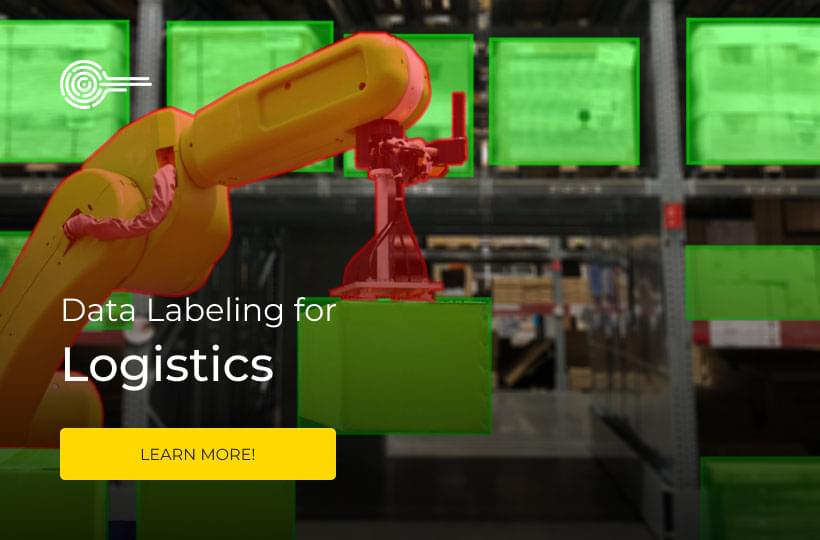
Computer Vision, AI and Data Annotation in Municipal Study Processes
Drones are increasingly part of the lives of cities. Some of the main uses of drones by local city governments include studies, inspections and surveys. Yes, drones are often autonomous or partially autonomous, meaning they are flown by AI and seem to fly themselves. However, like cars, they still usually require licensed human pilots. Also the use cases are actually more interesting.
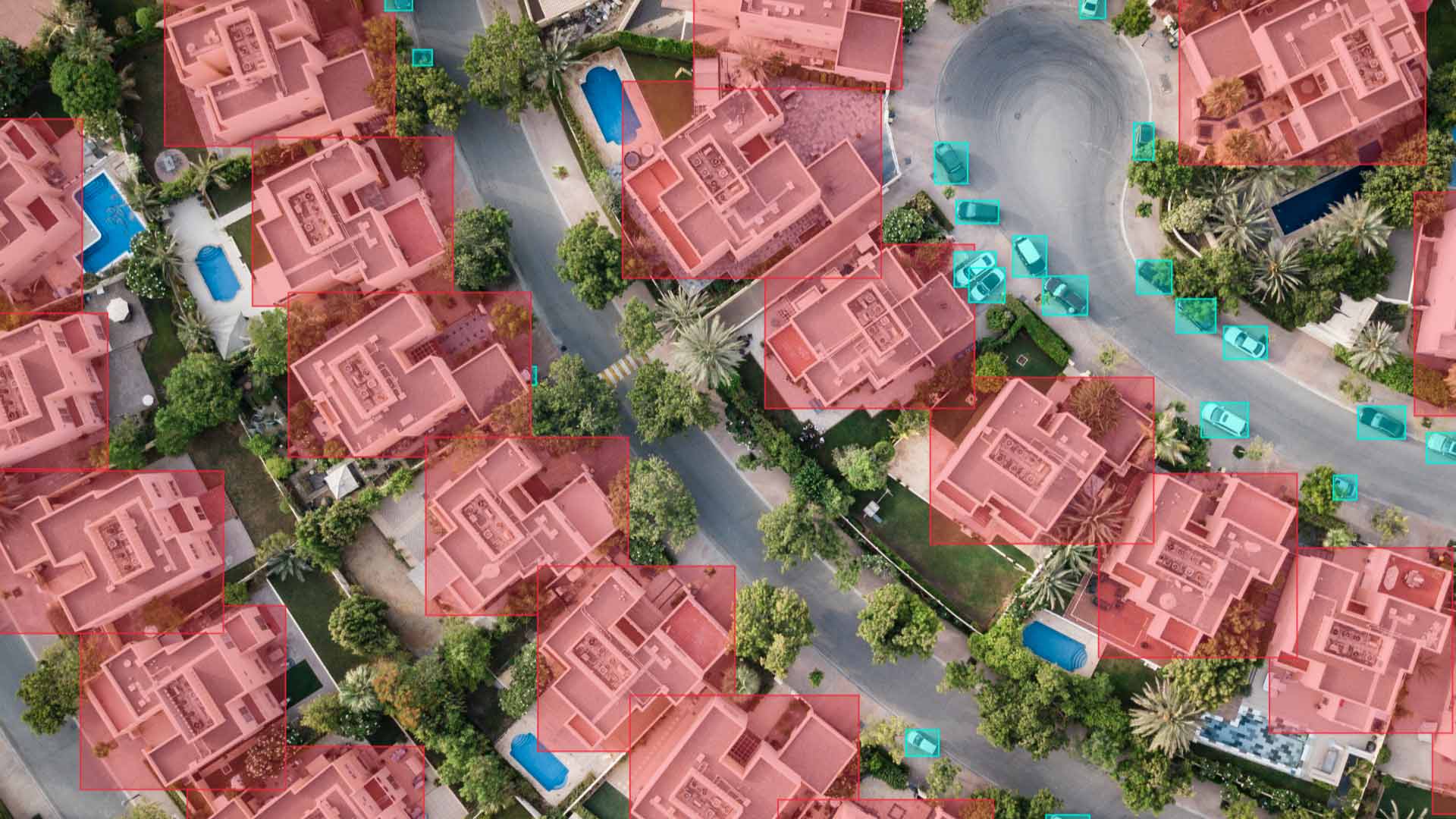
It is much safer and less expensive to send a drone into dangerous areas like underground tunnels or disaster zones. It is also much more convenient and accurate to fly a drone to do something like a land survey and understand the borders of different land parcels. In almost all municipal use cases for drones, data accuracy is critical. For example, consider the study of a high rise building for structural integrity, things like cracks in the cement.

Yes, you could send an engineer up to do a manual inspection. The problem is that it is expensive and dangerous. It is even more dangerous if that inspection is really needed, because there are problems with the building to be found. So instead of paying the high cost of sending an engineer up the side of a building and taking the higher risk to human life, it is better to fly a drone up instead.
Of course operating a drone like an UAV is currently its own specialized set of skills and a different career path from the usual engineer. So, that is why the UAV gets equipped with sensors and cameras enabled with computer vision. That way the images can be reviewed by an engineer in safety. Because of advances in computer vision and AI, the drone can also look for cracks in cement and other problems and identify them.
Developing such a UAV equipped with CV to study the structural integrity of buildings is of many good image annotation use cases. The model just needs to be trained to look for the cracks in the cement and other problems. A conventional neural network (CNN) is enough for this kind of application. In fact, a lot of the development work is pretty standard and can be done with "off-the-shelf parts".
The most critical part is accurate detection and accurate data for training the model. This is an in demand solution for real problems. There is definitely a large market for this kind of product, and not all of the demand has come close to being met. You could develop the model, and we could provide all the accurate data and data annotation to train it.
It is well known that the USA has a lot of failing infrastructure. It is less well known the full extent of the damage and problems. However, there are at least 45,000 bridges, miles of tunnels, miles more of above ground electrical lines and even more that all need to be inspected. Of course it does not just need to be inspected and it also needs to be repaired. It is a kind of national technical debt.
Key Points
- There are many use cases for drones equipped with artificial intelligence and computer vision.
- These use cases are also business opportunities!
- Drones with CV are needed to improve building and infrastructure inspections.
- Drones are needed to inspect power lines safely.
- Drones are needed for traffic analysis..
- Drones are needed for firefighting and disaster relief.
- Accurate data and precise data annotation is vital to develop drones suitable for the use cases mentioned here.
More Use Cases for UAVs, CV and Image Data Annotation for Municipalities
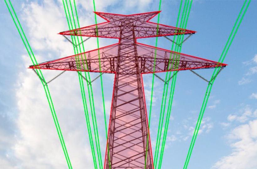
The USA’s electrical grids are in a sad state despite the desire to fully electrify cars and kitchens. Failed power lines have caused many tragic disasters and cost human lives. The same way that sending a drone up to inspect a building is safer it is also safer to send a drone up to inspect power lines instead of a human lineman. Yes, utility companies sometimes do overhead helicopter inspections. However, that is both expensive and inefficient. Flying a drone to do the inspection is safer and more cost effective too.
Creating specific products to solve the problem is again pretty standard development. The most important is of course accurate detection, accurate data and accurate data annotation. The demand for drones to use on the job by linemen is high. So you could develop the product, and we could provide the data and data annotation to train your model. Just keep in mind that for USA markets, the drone may need to be NDAA (national defense authorization act) compliant.
Drones are also useful for traffic analysis and surveying the scenes of traffic accidents. To enable this the data annotation needed is similar to the data annotation for self driving cars. Drones can also be helpful for disaster relief and fighting fires. Even say fires caused by a failed building, traffic accident or downed power line. All real problems that can be solved with the right technologies.
All of these use cases also represent unmet needs and market demand, at least in the USA. Besides the drones, the computer vision just takes accurate data and precise image data annotation to train the model. That last part is critical and the most important to create a successful product.