Creating Datasets for Drone Navigation & Collision Avoidance

The main goal of such datasets is to train the model to recognize obstacles, estimate distance, and safely plan a flight path. The most common types of data are images from cameras, which can be regular RGB, infrared, or stereo, allowing you to see the depth of the scene. Depth maps or LiDAR data are often added to more accurately determine the distance to objects. Annotated trajectories are also needed to train the models, where safe paths and potential collisions are indicated.
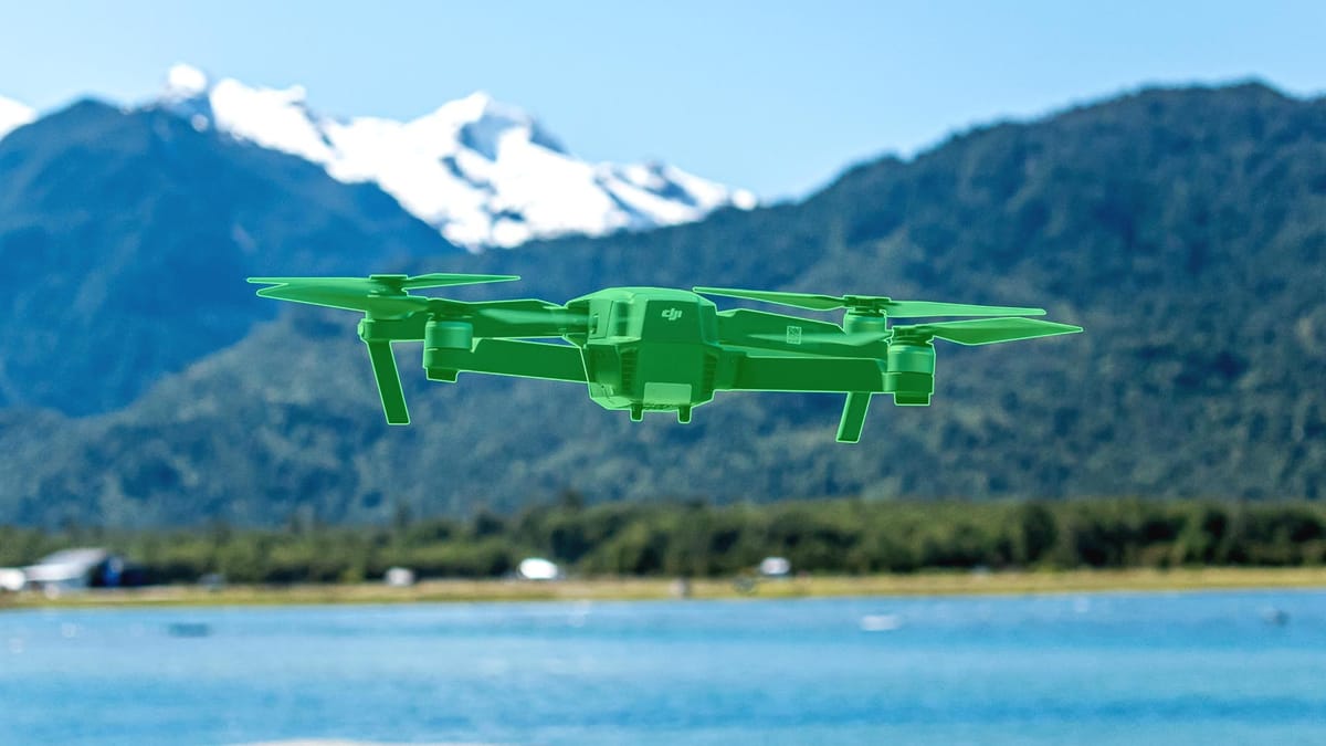
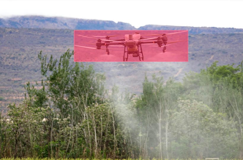
Data annotation is the most paramount part. Images are marked with frames for objects that create obstacles, or segmentation with classification (instance segmentation) is performed to distinguish objects of the same type from each other.
Key Takeaways
- Certifiable navigation systems require deterministic code rather than experimental AI models.
- FAA-compliant solutions combine real-world testing with scenario-based simulations.
- Safety-focused datasets must account for both routine operations and edge cases.
- Algorithm-driven systems demonstrate higher certification success rates than AI-dependent approaches.
- Continuous monitoring protocols are essential for maintaining aviation safety standards.

Waypoints and Environmental Awareness
By having predefined points in space that the drone must fly through during a mission, the drone can sense and react to its environment in real-time. These define the route or trajectory of the flight. For example, in cargo delivery, the drone may have a set of points from a warehouse to a destination that it must pass through to reach its destination. To accomplish this, the drone utilizes cameras, LiDAR, ultrasonic sensors, GPS, and an IMU.
Safety Through Multi-Layered Detection
Rather than relying on a single sensor or method, multiple sources of information are combined to avoid collisions and adapt to the environment more reliably.
The first level is usually based on simple near-field sensors, such as ultrasonic or infrared sensors. They respond quickly to obstacles near the drone and provide immediate collision avoidance at short distances.
The second level is cameras and computer vision, which allow you to identify obstacles, estimate their size, shape, and distance. Here, segmentation, object detection, and stereo vision algorithms can be applied to gain a deeper understanding of the scene.
The third level is far-field sensors, such as LiDAR or radar, which create an accurate three-dimensional map of the environment over a long distance. The drone can plan trajectories, avoid large objects, and predict potential hazards before they become critical.
If one sensor misses an obstacle due to limited conditions (for example, ultrasound is not practical due to noise or the camera is blinded by the sun), another sensor can detect it.
Leveraging Autonomous Flight Data for Safer Drone Operations
The model is trained on data collected during autonomous flights. The idea is that each flight contains information about routes, obstacles, drone actions, speed, altitude, environmental changes, and even unsuccessful maneuvers. This data can include point-cloud labeling, where each object in 3D space is labeled for further analysis, or obstacle segmentation, which enables the separation of obstacles from safe areas in the scene.
Analyzing such data allows the system to learn from its own experience. For example, based on flight history, the drone can adjust routes between SLAM landmarks, avoid areas with high obstacle density, and optimize trajectories. If the drone has previously experienced difficulties in a particular environment, the system can prevent the same mistakes in the future.
It also enables predictive safety, as the system can predict potential collisions or problem areas before they become critical by adjusting the altitude, speed, and direction of flight between SLAM landmarks.
Data-Driven Developments in Drone Autonomy and Flight Systems
Such systems widely utilize SLAM landmarks to construct a real-time map of the environment. These points help the drone determine its own position and orientation in space, even in environments without GPS. Together with sensor data, drones create point-cloud labeling, i.e., three-dimensional models of the scene with marked objects, which allows the systems to distinguish between obstacles and safe areas.
Obstacle segmentation is also actively used to determine which objects pose a threat to the flight accurately. Based on this data, the system can predict potential collisions, adjust the route, and make informed decisions about changing altitude or speed, thereby increasing flight safety.
Thanks to this approach, modern drones learn not only in simulations, but also in real flights, accumulating knowledge about complex environments, changing lighting conditions, weather factors, and moving objects. Data from different sources is integrated, allowing the autonomous flight system to predict potential problems and make operations more reliable.

Innovations in Flight Path Management
- Real-time dynamic obstacle prediction. New systems use algorithms that analyze moving objects and people in the drone's path. Thanks to obstacle segmentation, the drone can predict the trajectory of objects and adjust its path well in advance of a potential collision.
- Intelligent energy optimization. Modern approaches consider factors such as flight altitude, wind, and obstacles to minimize energy consumption. The use of point-cloud labeling helps to more accurately determine areas where detours are worthwhile, without wasting unnecessary energy on unnecessary maneuvers.
- A hybrid combination of GPS and SLAM landmarks. New systems combine global GPS coordinates with local SLAM (Simultaneous Localization and Mapping) landmarks to enhance route accuracy in urban or indoor environments where the GPS signal is weak or unstable.
- Adaptive change in altitude and speed along the trajectory. Modern algorithms analyze the point cloud in real time and determine the optimal altitude for safe and efficient flight between obstacles, while taking into account speed limits and energy costs.
- Self-learning routes based on simulations and real flights. Drones use accumulated data to train models that can predict complex combinations of obstacles. Obstacle segmentation enables you to recreate high-risk scenarios in simulators, allowing the drone to learn to avoid challenging situations without physical risk.
Advanced Air Mobility and Urban Integration
Advanced Air Mobility (AAM) refers to the introduction of autonomous or semi-autonomous drones and aircraft into urban environments for transportation, cargo delivery, monitoring, and other services. The main challenge is integrating these devices into an already saturated air and ground environment, where new obstacles constantly appear, ranging from buildings to dynamic objects such as other drones, helicopters, or even birds.
For the effective integration of AAM, SLAM landmarks are utilized, enabling drones to navigate in urban canyons and between tall buildings, even when the GPS signal is weak or unavailable. Local landmarks form "safety maps" that drones can use to determine optimal paths and precise positions within the city. A key component is point-cloud labeling: drones scan the city in 3D, marking buildings, street structures, and other objects, which enables trajectory planning algorithms to account for all obstacles in real space.
Obstacle segmentation is also used to dynamically separate moving obstacles, such as vehicles, people, or other drones, from static objects.
Integrating AAM into urban infrastructure involves not only autonomous navigation, but also cooperation with air corridors, traffic control centers, and digital city maps.
Overcoming Implementation Challenges and Regulatory Hurdles
- Data and format standardization. One of the key challenges is the lack of a single format for sensor data, maps, and annotations. Point-cloud labeling and unified obstacle segmentations allow for the creation of cross-platform compatible datasets for training autonomous systems.
- Integration with existing urban infrastructure. Drones must operate in dense urban environments. SLAM landmarks enable drones to navigate between buildings and other structures, even in the absence of stable GPS, making it easier to integrate them into real-world urban corridors.
- Realistic environment modeling. Certification and testing of autonomous systems require simulations that closely resemble the real world. Obstacle segmentation helps separate static and moving objects in a virtual environment, providing more accurate testing of collision avoidance algorithms.
- Regulatory and safety support. Lawmakers are demanding evidence of the safety of flights in urban environments. Using multi-layer data analysis with SLAM landmarks and point cloud labeling enables you to document trajectories, predict risks, and provide evidence of system reliability for regulators.
- Learning from errors and improving algorithms. Drones that collect data from real flights use obstacle segmentation to analyze situations where close encounters or errors occurred.
Summary
Modern drones have learned to fly independently, not only thanks to cameras and GPS, but also thanks to the "understanding" of the space around them. SLAM landmarks allow them to see exactly where obstacles are, and obstacle segmentation helps them quickly decide what to fly around.
Drones can analyze the environment in real-time, predict the movement of people, cars, or other drones, and adjust the route on the fly. And when regulatory or technical difficulties arise, modern systems collect data, test algorithms in simulations and on real flights, learning from their own mistakes.
FAQ
What are Waypoints in drone navigation?
Waypoints are predefined points along a route that a drone must pass through. They help plan the trajectory and control speed, altitude, and direction.
How does Multi-Layered Detection work?
It uses multiple sensors and algorithms simultaneously to monitor the environment. If one sensor misses an obstacle, another detects it, improving flight safety.
What are SLAM landmarks, and how do they help a drone?
SLAM landmarks are local reference points used for mapping and localization. They are instrumental when GPS signals are weak or unavailable.
What is point-cloud labeling for?
Point-cloud labeling involves marking objects in 3D space. It helps the drone distinguish obstacles, buildings, and safe zones for route planning.
What is Environmental Awareness, and why is it important?
Environmental Awareness is the drone's ability to sense and respond to its surroundings. It enables the drone to avoid obstacles, estimate distances, and adjust its path in real-time.
What is obstacle segmentation and its role?
Obstacle segmentation identifies obstacles in the environment. It enables the drone to react quickly to both static and moving objects, thereby avoiding collisions.
How does autonomous flight data improve safety?
Drones record trajectories, sensor data, and past errors. Analyzing this data helps predict risks and optimize routes to prevent future collisions.
What role do simulations play in drone training?
Simulations provide a controlled environment for testing algorithms. They allow drones to practice obstacle avoidance and complex scenarios without risking real equipment.
How do drones adapt to urban environments in Advanced Air Mobility (AAM)?
They utilize SLAM landmarks for positioning between buildings, point cloud labeling for 3D mapping, and obstacle segmentation to avoid moving objects. This enables safe integration into city airspace.
What are the main challenges in deploying autonomous drones in cities?
Key challenges include meeting regulatory requirements, standardizing data, and ensuring safe integration with existing infrastructure. Multi-layered sensor data, 3D mapping, and obstacle segmentation help overcome these challenges.

